- Home
- News / events
- Avenue Road
- Biggin
- Buckingham Road
- Census 1841
- Chapels
- Charities & poor relief
- Church
- Church Street
- Directories / descriptions
- Enclosure
- Families / people
- Farms
- Fire insurance
- High Street
- Horn Street
- Maps
- Market Square
- Medieval & 16th century
- 19th-20th Centuries
- Oral history
- Parish Council
- Photographs
- Pubs
- Railway
- Redfield
- Schools
- 17th-18th Centuries
- Sheep Street
- Shipton
- Station Road
- Tanneries
- Tinkers End
- Turnpike
- Vicarage & Verney Roads
- Western Lane
- Wills
- Windmill
- Winslow Hall
- Workhouse / Hospital
- World War One
- Sitemap
- Links
- Search site
- About us / contact

Aerial photographs of Winslow
Some high resolution versions of 1931 aerial photos are available from the Historic England website. They are higher resolution than the printed photos further down the page, and you can click on them to zoom in. The photos might not work in older browsers.
Winslow from the north. Winslow United football pitch in Great Horwood Road, Selby Villa (the White House), railway bridge and Buckingham Road in the foreground.
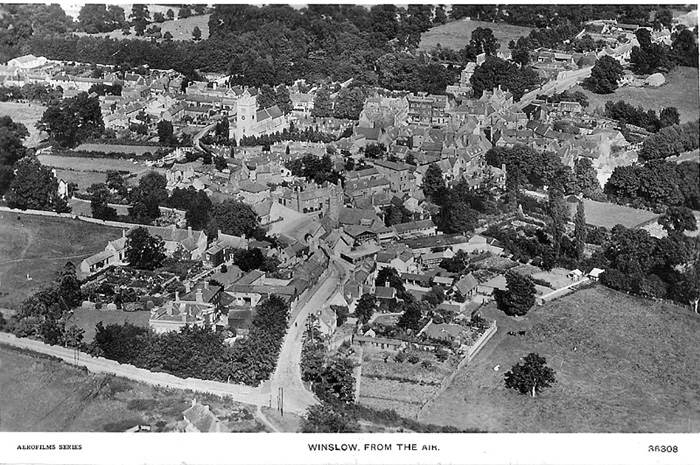
Winslow from the south-east (1931). Home Close is in the foreground.
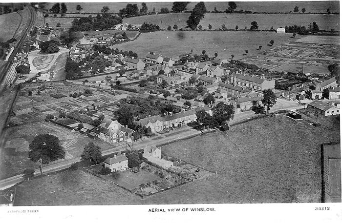
Winslow from the north-west (1931). Buckingham Road is in the foreground, before the development of the western side. The station and marshalling yard are in the top left. The fields and allotments in the top right are now the Magpie Farm and Lowndes Way estates.
There is a higher resolution version on the Historic England website.
Winslow from the west (1931). In the foreground are Burleys Road (before any houses were built) and Horn Street. The large house behind the trees is Western House (now demolished; Bevan Court is on the site).
Click here for a higher resolution version from Historic England.
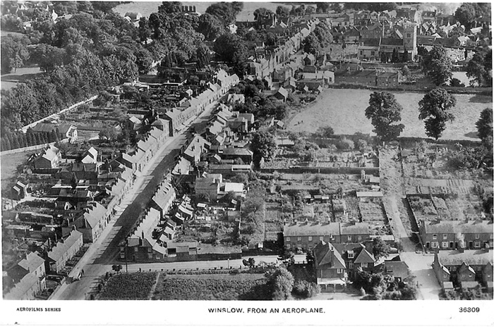
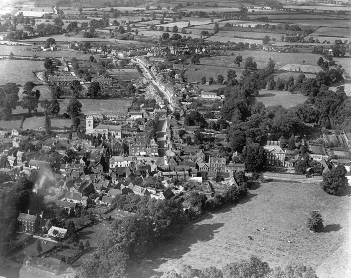
The High Street from the north (1931). Avenue Road is in the foreground. The field mid-right (the Flower Show Field) became St Albans and St Laurence Roads.
Click here for a higher resolution version from Historic England.
Winslow from the south (1931), before the town expanded eastwards with the Lowndes Way and Elmfields estates. Lawn House is in the bottom left corner.
Click here for a higher resolution version from Historic England.
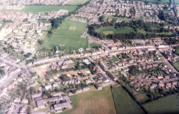
This photo from 1988 shows Winslow from the west, looking towards the Recreation Ground
Ridge and furrow fields in Shipton (2007). Historic England photo. Looking west: Aylesbury Road runs to the left, Swanbourne Road to the right.
More ridge and furrow in Shipton. Looking south-west: Aylesbury Road runs across the photo.
Rooftop photographs
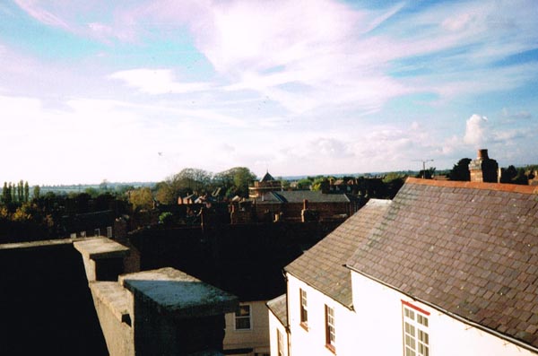
These five photographs were taken c.1990 from the roof of Midgleys' ironmongers (3 Market Square). In the first, looking west, the George is in the foreground, and the tower of the Congregational Church in the centre.
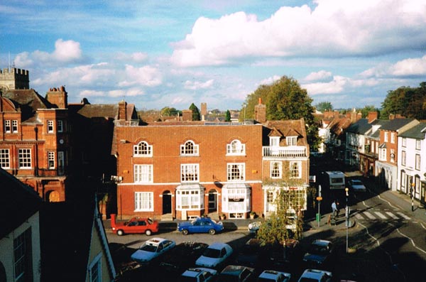
The second, looking north, shows the Market Square and part of the High Street.
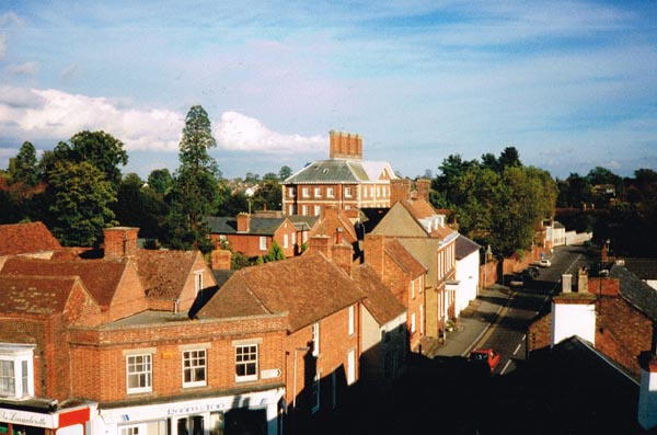
The third, looking east, shows Sheep Street, with Winslow Hall and Brook Hall in the centre of the photo.
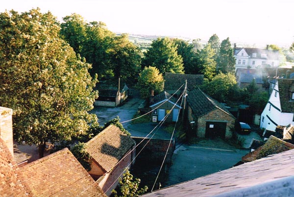
This one, looking south, shows the Cattle Market (left), Keach's Chapel (the furthest roof in the centre) and Lawn House (back right).
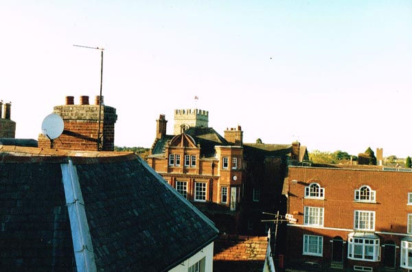
This shows an unusual view of Lloyds Bank (formerly the Bucks & Oxon Union Bank, built 1891), with The George at the front.
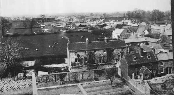
View from the Church tower, c.1885
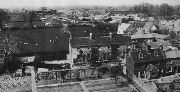
The photographer was looking northwards. Vicarage Road (south side only) is in the foreground, then fields where St Albans Road and Avenue Road are now. Further back you can see Buckingham Road (east side only), the Workhouse and grounds, both sides of the High Street, Station Road (north side only) and the Baptist Church. The field with trees in the top right corner is now the Recreation Ground. The original photo is printed on canvas. Click here for a larger version (1.91 MB).